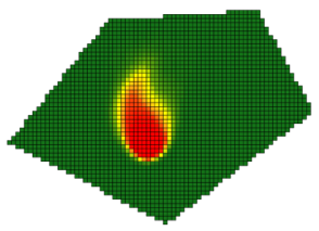
 Demarcation of a spring capture zone must account for the fact that local hydraulic properties may be heterogeneous. It must also account for the fact that hydraulic conditions around the spring are inexactly known. Spring capture zone analysis must therefore be probabilistic, with all of these uncertainties taken into account.
What is known, however is the amount of water that flows from the spring. This must be respected by stochastic representations of conditions around the spring.
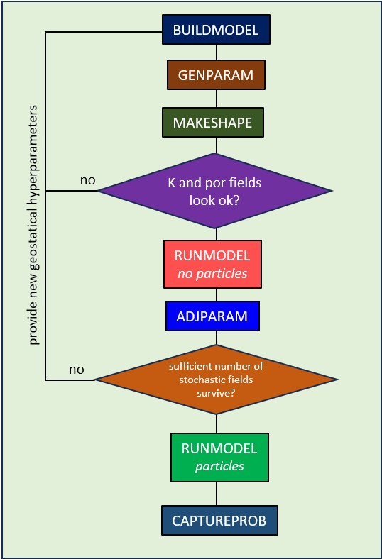
An easy-to-follow workflow is implemented by 7 programs that enable stochastic spring capture zone analysis with all of these factors taken into account. Collectively, the programs enable model construction, stochastic expression of model boundary conditions and local hydraulic properties, enforcement of the spring flow constraint on these realizations, and demarcation of a probabilistic spring capture zone. A point is deemed to lie within the capture zone of a spring if a particle that is released at that point reaches the spring within a user-specified time.
All programs run fast. The entire workflow can generally be completed within minutes. The outcomes of capture zone analysis are then easily imported into a GIS or other package for further analysis and reporting.
MODFLOW 6 is used to simulate movement of water and particles. The model grid is generated automatically. The user simply provides a number of points that surround the spring, and assigns heads to these points. Heads can be uncertain.
The model grid is populated with stochastic hydraulic conductivity and porosity fields. The user provides mean hydraulic property values, hydraulic property uncertainties, and spatial correlation lengths of hydraulic property heterogeneity. If desired, hydraulic property fields can be anisotropic in order to reflect structural control of local groundwater flow. (Future versions may allow the use of nonstationary geostatistics.)
Once the model has been built, it is run many times using different realizations of boundary heads and hydraulic properties. Each realization is adjusted (within user specifications) until modelled spring flow matches observed spring flow (which can itself be a stochastic quantity).
The model grid, populated with adjusted stochastic hydraulic property fields, is then populated with particles. MODFLOW 6 is used again to track all particles from all model cells in order to detect where they emerge from the groundwater system. If the particle assigned to a particular model cell is captured by the spring within a user-specified time, then that cell is deemed to lie within the spring capture zone. The greater is the number of times that this occurs for different realizations of hydraulic property fields and boundary heads, the greater is the likelihood that the model cell lies within the true spring capture zone.
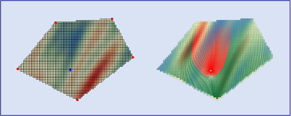 Outcomes of the capture zone analysis process are recorded in shapefiles. These are readily imported into a GIS for further analysis and display.
The spring capture zone analysis software reads its input data from easily-prepared text files. HydroSymple has developed a basic graphical user interface to make data entry and capture zone analysis/display interactive. Contact us if you would like this interface.
Or build your own interface in a few moments using an AI package such as Claude. It’s easy.
Programs comprising the spring capture zone analysis workflow were developed by Watermark Numerical Computing with support from Kataclima, Italy.
